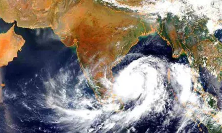
Cyclone Montha: Chennai likely to get steady spells of rain; no flood threat, says TN Weatherman
In a social media post, he said that while there is understandable fear among Chennai residents following the 2015 and 2023 floods, the current rainfall pattern would mostly consist of steady rain, drizzles, and intermittent intense spells through Monday and early Tuesday (October 28).

Representative Image (Cyclone)
CHENNAI: Even as Cyclone Montha, located about 550 km from Chennai over the southwest and adjoining southeast Bay of Bengal and moving northwest at 16 kmph, is expected to bring heavy to very heavy rain to the city and neighbouring districts on Monday, weather blogger Pradeep John (Tamil Nadu Weatherman) said the showers are likely to be steady, with no major flood threat.
In a social media post, he said that while there is understandable fear among Chennai residents following the 2015 and 2023 floods, the current rainfall pattern would mostly consist of steady rain, drizzles, and intermittent intense spells through Monday and early Tuesday (October 28).
According to him, north Chennai and coastal areas are expected to receive 50–70 mm of rainfall, with Gummidipoondi and Pulicat likely to get up to 100 mm, while south Chennai may record around 30–50 mm, spread-out across the day.
He added that areas within 2 km of the coast could also receive between 50–70 mm of intermittent spells throughout the day. “Heavy rains do not mean floods,” John clarified, urging residents to note the official classification of rainfall: light (2.5–15.5 mm), moderate (15.6–64.4 mm), heavy (64.5–115.5 mm), and very heavy (115.6–204.4 mm).
While the stretch from north Chennai to Pulicat and areas very close to the sea might see heavier spells, he said rainfall from Cyclone Montha would largely remain “pleasant and well spread-out,” easing fears of urban flooding.
Meanwhile, the cyclone is expected to move northwest over the southwest and westcentral Bay of Bengal for the next 12 hours, then turn north-northwest and intensify into a severe cyclonic storm by Tuesday morning. It is likely to make landfall near Kakinada on the Andhra Pradesh coast by Tuesday evening or night, with wind speeds of 90–100 kmph and gusts up to 110 kmph, according to the India Meteorological Department (IMD).


