Cyclone Ditwah HIGHLIGHTS: Depression moves inland, heavy rain alert for Chennai
The system is bringing continuous heavy to extremely heavy rainfall, gusty winds of 40–60 km/h, and widespread waterlogging across coastal areas.

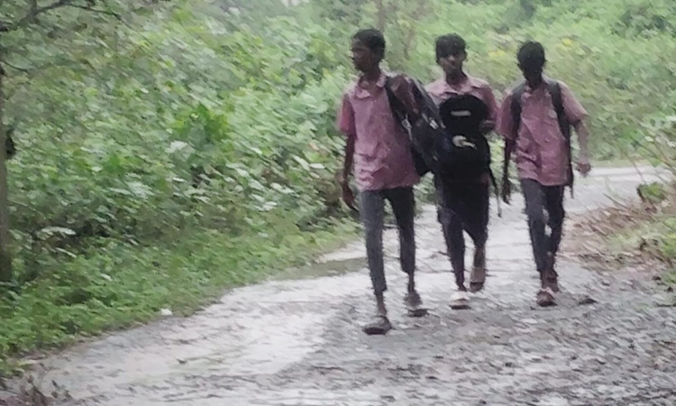
Water stagnated in the main road
CHENNAI: Coastal Tamil Nadu and certain interior parts in the state experienced widespread rain on Wednesday as the depression weakened into a well-marked low-pressure area. Chennai, Thiruvallur are and Chengalpattu to receive heavy rains, said IMD.
IMD has announced an orange alert for 7 districts - Chennai, Thiruvallur, Chengalpattu, Kancheepuram, Ranipet, Nilgiris and Coimbatore.
Yellow alert for, Ariyalur, Perambalur, Thanjavur, Tiruvarur, Nagapattinam, Pudukottai, Tiruchirapalli, Ramanathapuram, Theni, Thenkasi, Tirunelveli and Karaikal.
“The depression (remnant of cyclonic storm Ditwah) over southwest Bay of Bengal and adjoining north Tamil Nadu-Puducherry coasts moved slowly southwestwards and weakened into a well-marked low-pressure area over north Tamil Nadu-Puducherry coasts and neighbourhood,” the IMD said.
It was very likely to continue to move southwestwards slowly across north coastal Tamil Nadu and Puducherry and weaken further into a low-pressure area during the next 24 hours, the weather office said in its bulletin associated with this system.
Villupuram, Cuddalore, Tiruvannamalai too experienced heavy frequent spells with brief intervals, as the depression moved inland.
Live Updates
 3 Dec 2025 1:42 PM IST
Flood Alert
- Increased water release in Sembarambakkam and Puzhal lakes, flood warning for low-lying areas in Chennai suburbs
- According to the Meteorological Department, owing to the expected heavy rainfall and the continued increase in water levels, Sembarambakkam Lake has now reached 21.96 feet of its total capacity of 24 feet.
- Consequently, Water Resources Department officials have decided to release 200 cubic feet of water from the lake from 8 am today, Wednesday. The lake is receiving 1,380 cubic feet of water per second. O
- 3 Dec 2025 10:18 AM IST
RMC: Depression of the remnant of Cyclone Ditwah weakened into a well-marked low-pressure system on Wednesday
- On the third consecutive day the cold, cloudy weather, accompanied by moderate to light rain, drenched the city on Wednesday morning.
- The Regional Meteorological Centre (RMC) forecast that the depression of the remnant of Cyclonic Storm Ditwah weakened into a well-marked low-pressure area over the North Tamil Nadu-Puducherry coasts.
- Greater Chennai Corporation’s (GCC) 24 hours cumulative rainfall report ending at 5:30 am on Wednesday recorded an average rainfall of 6 .7 cm in several locations across the city.
ALSO READ: RMC: Depression of the remnant of Cyclone Ditwah weakened into a well-marked low-pressure system on Wednesday - 3 Dec 2025 8:29 AM IST
North, central Chennai bear brunt of cyclone for second day
- Parts of north and central Chennai bore the brunt of the downpour. The worst-affected areas included Kannigapuram, Perambur, Mullai Nagar, Ezhil Nagar, Mettupalayam, Pattalam and Purasawalkam, as well as pockets of Nungambakkam, Kodambakkam and Kilpauk.
- In Mullai Nagar, Ezhil Nagar, Sathaya Moorthi Nagar, Mangalapuram and surrounding areas, including dense working-class localities in Tondiarpet and Vyasarpadi, residents faced persistent flooding.
- Residents across these neighbourhoods said repeated flooding after every spell of rain pointed to persistent gaps in stormwater management and civic preparedness.
Prithiv Raj Anbu
ALSO READ: North, central Chennai bear brunt of cyclone for second day - 3 Dec 2025 8:25 AM IST
10 districts likely to receive moderate spells
- The remnant of Cyclone Ditwah, now a deep depression over the southwest Bay of Bengal, is edging towards the Chennai–Puducherry and south Andhra Pradesh coast. The system is bringing continuous heavy to extremely heavy rainfall, gusty winds of 40–60 km/h, and widespread waterlogging across coastal areas.
- IMD has announced an orange alert for 10 districts - Chennai, Thiruvallur, Chengalpattu, Kancheepuram, Villupuram, Kallakurchi, Tiruvannamalai, Cuddalore, Mayiladuthurai and Puducherry.
- Yellow alert for, Ariyalur, Perambalur, Thanjavur, Tiruvarur, Nagapattinam, Pudukottai, Tiruchirapalli, Ramanathapuram, Niligiris, Ghat areas of Coimbatore, Theni, Thenkasi, Tirunelveli and Karaikal.
- 2 Dec 2025 11:52 PM IST
Check which districts have declared rain holiday on Dec 3
Update: Schools and colleges in Tiruvallur, Chennai and Kancheepuram will remain closed for a second day, on December 3, due to heavy rain and flooding caused by Cyclone Ditwah. Schools in Chengalpattu will be shut tomorrow.
- 2 Dec 2025 11:41 PM IST
Ditwah effect: Heavy rains in Western Ghats, south TN on Dec 3
Ditwah weakened from a deep depression to a depression on Tuesday morning.
North Chennai continued to receive heavy rain; Ennore recorded 26 cm, Parrys 25 cm, Ice House 22 cm, Manali New Town & Ponneri 21 cm, Basin Bridge & Perambur 20 cm.
System was 80 km from Chennai and 60 km from Puducherry at 5.30 p.m.; moving slowly (~3 kmph).
Minimum distance to TN–Puducherry coast: 25 km; expected to move southwest and weaken into a well-marked low in 12 hours.
Orange alert issued for the Western Ghats for Wednesday.
Heavy to very heavy rain forecast on Wednesday for Nilgiris, Erode, Coimbatore; heavy rain in Theni, Dindigul, Tiruppur, Tenkasi, Tirunelveli, Kanniyakumari, Salem, Namakkal.
Fishermen advisory: Don’t venture into sea; winds 45–55 kmph, gusting 65 kmph till Dec 2 evening; easing to 35–45 kmph, gusting 55 kmph by Dec 3 morning.
Sea conditions: Very rough to rough till Dec 3 morning, gradual improvement thereafter.
- 2 Dec 2025 7:18 PM IST
Schools in Tiruvallur will remain closed on Wednesday (December 3), District Collector M Prathap announced, following the torrential rains and flooding caused by Cyclone Ditwah’s impact.
- 2 Dec 2025 5:19 PM IST
Ditwah pulls away from Chennai; several districts to get rains on Dec 3
-- Ditwah weakened into a depression on Tuesday, leading to the red alert being downgraded for Chennai and nearby districts.
-- The system was 60 km from Chennai and about 90 km from the TN–Puducherry coast, at 11.30 am, drifting south-southwest at 8 kmph.
-- It will move away slowly, hold intensity till evening, then weaken into a low-pressure area within 12 hours.
-- Dec 2: Orange alert remains for Chennai, Tiruvallur, Ranipet, Kancheepuram and Chengalpattu; yellow alert for Vellore, Tiruvannamalai, Villupuram, Cuddalore, Puducherry and Kallakurichi.
-- December 3: Nilgiris, Erode, Coimbatore may get very heavy rain; Theni, Dindigul, Tirupur, Tenkasi, Tirunelveli, Kanniyakumari, Salem and Namakkal may see heavy spells.
-- Winds of 45–55 kmph expected today along north coastal TN, easing tomorrow.
- 2 Dec 2025 2:43 PM IST
Red alert downgraded as Ditwah weakens near Chennai
-- The red alert issued earlier on Tuesday (Dec 2) was downgraded to an orange alert at noon for Kancheepuram, Tiruvallur, Chennai, Chengalpattu and Ranipet districts.
-- Dec 2: Yellow alert for Vellore, Tiruvanamalai, Villupuram, Puducherry, Kallakuruchi, and Cuddalore.
-- The remnant of Cyclonic Storm Ditwah weakened into a depression early Tuesday after drifting southwestwards at about 3 kmph, and at 8:30 am, it was around 40 km east-southeast of Chennai and about 25 km from the north Tamil Nadu–Puducherry coast.
-- The system is expected to continue moving slowly southwestwards towards the coast, maintain its intensity for the next 12 hours, and then weaken into a well-marked low-pressure area, according to the latest India Meteorological Department (IMD) bulletin.
- 2 Dec 2025 12:52 PM IST
Chennai police execute rescue and relief operations amid cyclone threat
- Following a weather alert predicting heavy rains and strong winds along the Tamil Nadu coast, Chennai Police Commissioner A Arun activated the Disaster Response mechanism.
- Approximately 18,000 police personnel from traffic, law & order, and special units have been deployed on an accelerated basis.
- Commissioner Arun stated that all police officers and personnel remain on high alert, working in an integrated manner with state departments. Necessary precautions and safety arrangements are in place to continue providing all required assistance to the public as the city weathers the cyclonic conditions.
ALSO READ: Cyclone Ditwah: Chennai police execute rescue and relief operations amid cyclone threat