Cyclone Ditwah HIGHLIGHTS: Depression moves inland, heavy rain alert for Chennai
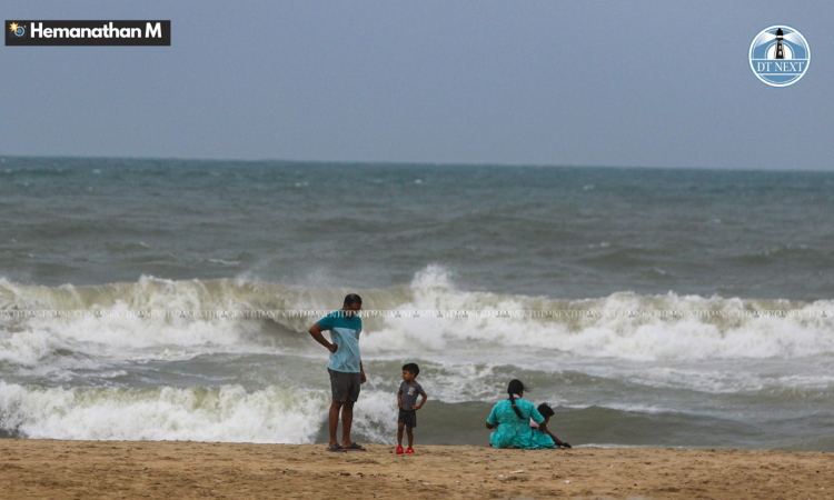
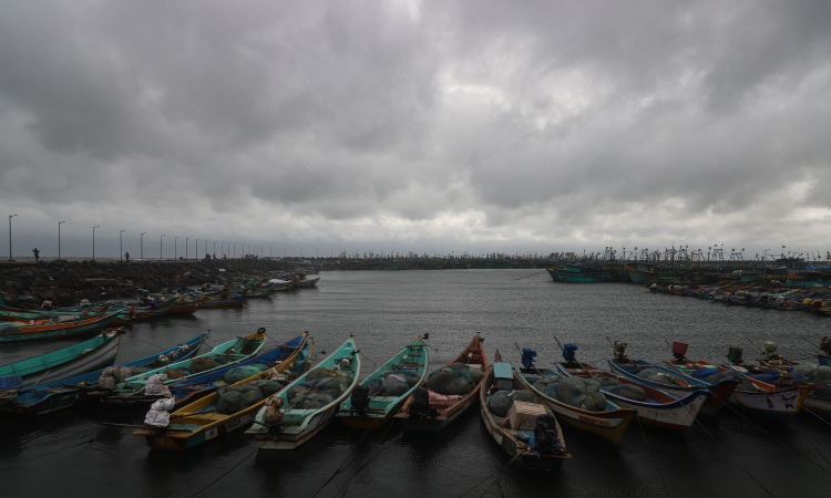
The system is bringing continuous heavy to extremely heavy rainfall, gusty winds of 40–60 km/h, and widespread waterlogging across coastal areas.

Water stagnated in the main road
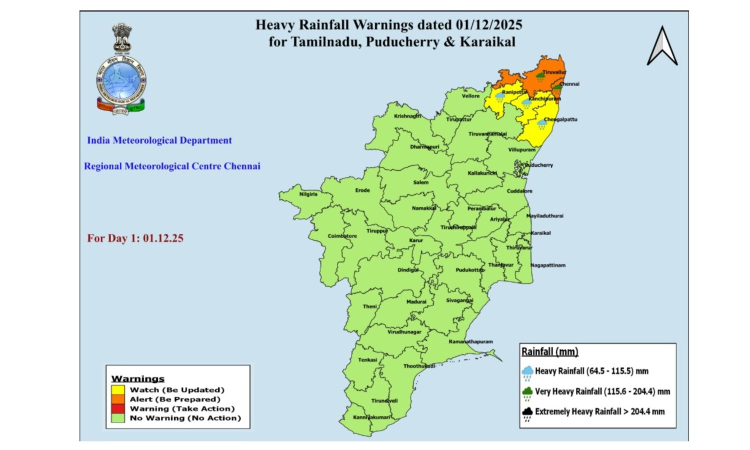
CHENNAI: Coastal Tamil Nadu and certain interior parts in the state experienced widespread rain on Wednesday as the depression weakened into a well-marked low-pressure area. Chennai, Thiruvallur are and Chengalpattu to receive heavy rains, said IMD.
IMD has announced an orange alert for 7 districts - Chennai, Thiruvallur, Chengalpattu, Kancheepuram, Ranipet, Nilgiris and Coimbatore.
Yellow alert for, Ariyalur, Perambalur, Thanjavur, Tiruvarur, Nagapattinam, Pudukottai, Tiruchirapalli, Ramanathapuram, Theni, Thenkasi, Tirunelveli and Karaikal.
“The depression (remnant of cyclonic storm Ditwah) over southwest Bay of Bengal and adjoining north Tamil Nadu-Puducherry coasts moved slowly southwestwards and weakened into a well-marked low-pressure area over north Tamil Nadu-Puducherry coasts and neighbourhood,” the IMD said.
It was very likely to continue to move southwestwards slowly across north coastal Tamil Nadu and Puducherry and weaken further into a low-pressure area during the next 24 hours, the weather office said in its bulletin associated with this system.
Villupuram, Cuddalore, Tiruvannamalai too experienced heavy frequent spells with brief intervals, as the depression moved inland.
Live Updates
- 1 Dec 2025 5:41 PM IST
Deep depression near Chennai moves north slowly
IMD's latest update: The remnant of Cyclone Ditwah remained a deep depression near the coast, sitting about 50 km east of Chennai and 35 km from the Tamil Nadu–Puducherry coast at 11.30 am while moving north at 3 kmph. It is expected to drift slowly north along the Tamil Nadu–Andhra Pradesh coast, weaken by evening and pass within around 30 km of Chennai, with radars in Chennai and Sriharikota tracking it.
Private weather bloggers claimed that rain intensity was likely to pick up in Chennai as the intense rain bands were moving into the city from the north. The cloud mass was now closer to the TN coast, with the bulk of cold tops brushing towards the Chennai belt
- 1 Dec 2025 11:37 AM IST
Ditwah nears Chennai coast, expected to weaken shortly
The deep depression, remnant of Cyclone Ditwah, is moving northwards along the TN–Puducherry–south AP coast.
At 5.30 am, it was 50 km from Chennai, 130 km NE of Puducherry, 150 km NE of Cuddalore and 200 km SSE of Nellore.
The system will continue moving slowly north, nearly parallel to the coast.
It is likely to weaken into a depression within 12 hours and come within 30 km of the Chennai coast by noon.
Orange alert (11–20 cm rain) issued for Chennai, Kancheepuram, Chengalpattu, Vellore, Ranipet, Tiruvallur, Tirupattur and Puducherry on December 1.
Yellow alert (6–11 cm rain) issued for Tiruvannamalai and Villupuram.
Gale winds of 60–70 kmph, gusting to 80 kmph, expected over north coastal TN, Puducherry and Karaikal.
Squally winds of 55–65 kmph, gusting to 75 kmph, likely over adjoining districts and south coastal TN.
- 30 Nov 2025 10:20 PM IST
Met Department Forecasts Widespread Rain Across Tamil Nadu as Cyclone Ditwah Nears
- The Chennai Meteorological Department had stated that light to moderate rain with thunder and lightning is likely to occur in many places in South Tamil Nadu, a few places in North Tamil Nadu, Puducherry and Karaikal areas today due to Cyclone Dithwa.
- 30 Nov 2025 6:32 PM IST
Cyclone Ditwah to intensify rainfall across Andhra: IMD
- Cyclone Ditwah, currently positioned over the southwest Bay of Bengal, is expected to intensify rainfall across Andhra Pradesh, bringing light to extremely heavy rain and squally winds of up to 70 kmph across NCAP, SCAP and Rayalaseema over the next two days.
- The system is moving along and off the Tamil Nadu–Puducherry coast, remaining 30–70 km offshore, and will enhance rainfall with thunderstorms across several districts; the IMD has forecast heavy to very heavy rain in coastal and southern Andhra regions.
- Andhra Pradesh Home Minister V. Anita reviewed preparedness with district officials, directing them to stay on high alert for 48 hours, ensure continuous warnings, clear fallen trees, restore power supply and keep rehabilitation centres ready for possible evacuations.
PTI - 30 Nov 2025 6:30 PM IST
400 Indian passengers stranded due to Ditwah evacuated from Sri Lanka
- Around 400 stranded Indian nationals were evacuated from Colombo airport on Sunday, with 150 flown to Delhi and 250 to Thiruvananthapuram on Indian Air Force aircraft that had earlier brought humanitarian aid.
- Sri Lanka remains under a state of emergency, with cyclone-induced floods and landslides causing over 200 deaths and major travel disruptions; distressed Indian citizens can seek help via the emergency helpline +94 773727832 (also on WhatsApp).
PTI - 30 Nov 2025 5:15 PM IST
Water release from Chembarambakkam lake halted as rain stops
- Rain has stopped in the catchment areas of Chembarambakkam Lake.
- Inflow to the lake has decreased significantly.
- Water release of 500 cusecs from the lake has been completely stopped from 4 pm, Water Resources Department said.


